Categories
Walking

Blog Update Note

As we leave Tehachapi tomorrow, we will be leaving behind the relatively populated Southern California. This also means cell phone coverage, and the ability to update this blog, will be limited too. We will do the best we can, but expect less frequent updates. I will be sending more updates to my Twitter account which I can update from anywhere via the InReach satellite text messaging device.

Categories
Walking

Day 44-45: Oak Creek to Tehachapi Pass

Friday was a short day hiking on the Pacific Crest Trail to Highway 58 and Tehachapi Pass, where we were met by White Jeep and Dal. They gave us a ride into the town of Tehachapi and swapped out the GPS trail logger with a new version with updated software.

We decided to take a zero day Saturday to rest and recover and escape the heat. This is only our second zero day of the hike not related to attending ADZPCTKO (the kickoff event.) The hiker friendly and very nice Best Western here is full of hikers doing the same thing.

We quickly got our chores done (lunch, showers, laundry, and groceries) and settled into our nice room. The pool and jacuzzi also awaited us.

Tomorrow we will start hiking a dry section of the PCT, and will likely have heavy packs due to the water we will need to carry. In about a week we will reach Kennedy Meadows and shortly after that we will be in the high mountains of the Sierra Nevada.

Photo: Tehachapi Pass

Trail Date: May 16-17th

Mileage: 8.2 miles

Categories
Walking

Day 43: Mile 538.6 to Oak Creek

We were happy to be back on real trail today as the heat and road walking the past two days have taken a toll on our feet. However the trail tread continued to be very sandy and we had three climbs today. Deb’s pinky toe has a pretty serious blister, and Lon had his first blister of the hike. Fortunately Lon’s blister is small and a little tape took care of it. Deb was not so lucky. Dr. Lon exercised his mastery with a needle and drained her blister with thread, which she left in overnight to dry out the blister.

Eventually the trail led to a (surprising to us) water cache with chairs. We were carrying enough water so we just signed the register. We encountered Heidi from the Pacific Crest Trail Association there too, doing some survey work in connection with the BLM to protect the trail from motorcycle use.

We camped at the first road crossing into Tehachapi, planning to finish the remaining 8 miles in the morning.

Photo: Tehachapi, the land of windmills and wind farms.

Trail Date: Thursday, May 15th

Mileage: 19.6 miles

Categories
Walking

Day 42: Hikertown to Mile 538.6

We got a 6:30 am start from Hikertown since it was forecast to be warm today.

The Pacific Crest Trail follows a covered aqueduct for 17 miles, so today was not exactly the scenic highlight of the trail.

One would think that flat walking would be easy for hikers but that wasn’t true for us. The road walking yesterday put different pressures on our feet. Today the “trail” options were to walk on the concrete covering the aqueduct or walk on the sandy jeep road beside it. Our feet were unhappy. Deb had to break out her iPod for the first time on this entire thru-hike. She is thinking her body isn’t designed for road walking. Her hint for future hikers is to consider taking a zero at Hikertown to give the body a rest between the two road walks.

When we reached the Cottonwood Creek Bridge we joined 10 other hikers relaxing in the shade waiting out the afternoon heat. We fixed dinner and about 5:30 hiked on to an awesome hilltop campsite above the windmills. We had views of the town lights, the full moon, and we were surrounded by the red blinking lights on the windmills. Surreal.

Photo: The view from camp above the wind farm.

Trail Date: Wednesday, May 14th

Mileage: 21 miles

Categories
Walking

Day 41: Casa de Luna to Hikertown

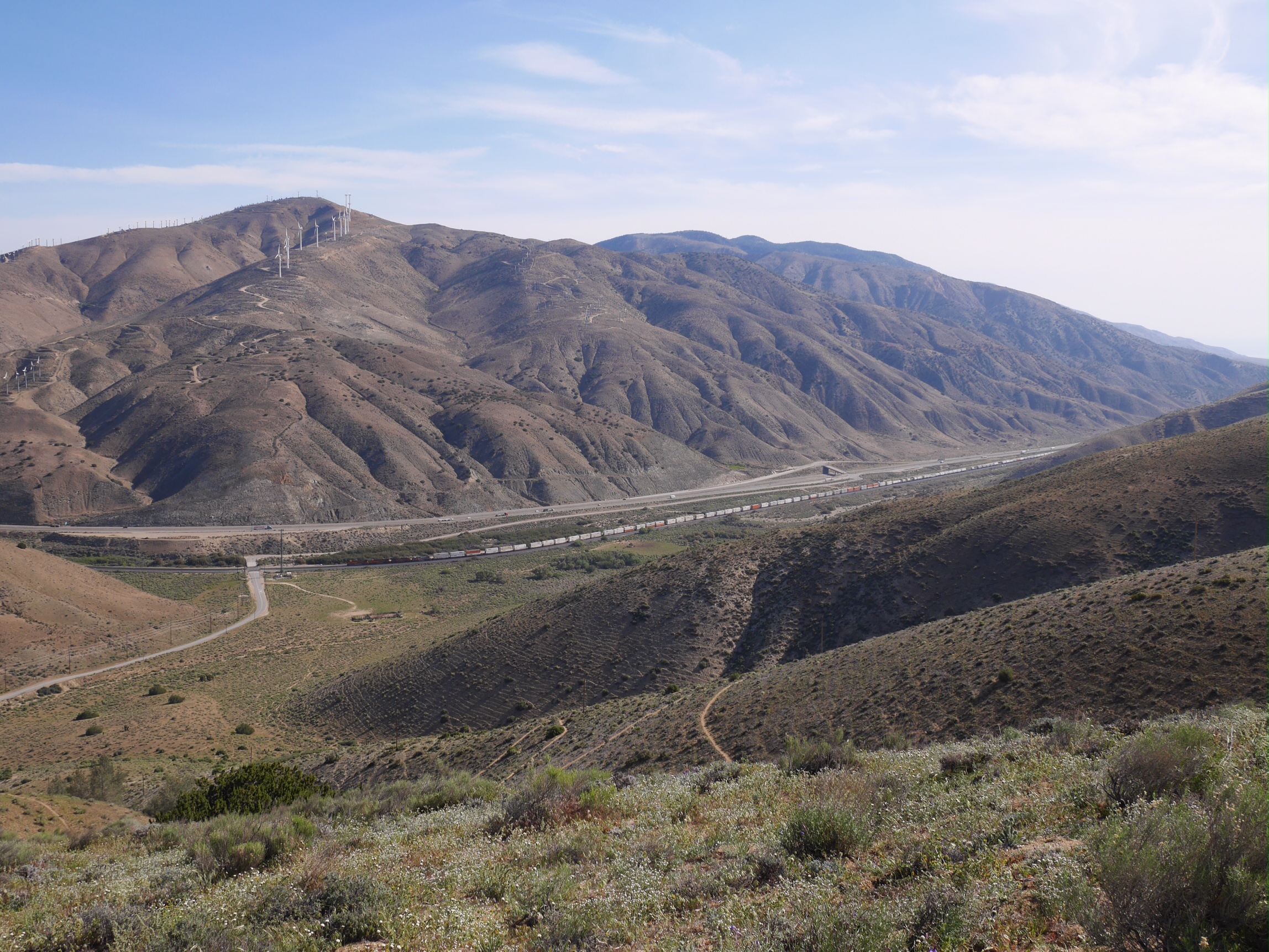
This section of the Pacific Crest Trail has a concentration of three trail angels, and thanks to the Power Fire closure, and the road walk as a result, we walked from Casa de Luna to Hikertown today. The road walk was about 20 miles and we ended up bypassing about 40 miles of the PCT.

The walk did take us into Lake Hughes where hikers can get snacks (and actually resupply) at the small store, or get a meal or room at the Rock Inn. We ate ice cream bars as our second breakfast and walked on. And on and on and on. The road walk got tedious near the end of the day and Deb was happy to see the last of the painted white line on the road.

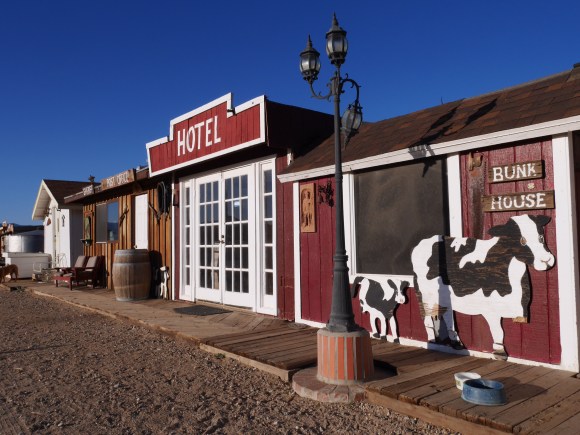
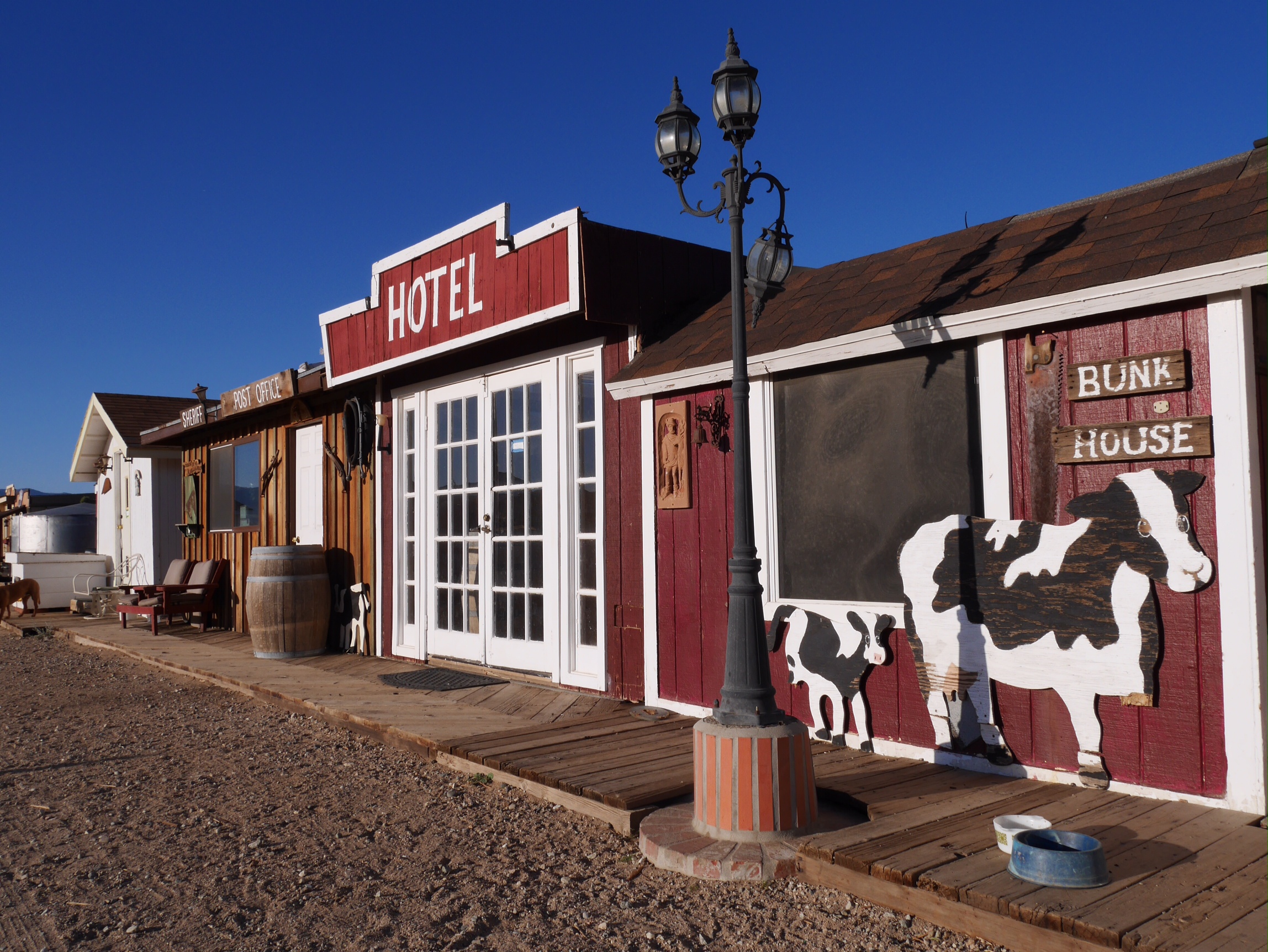
Hikertown is an interesting place. A little like a movie set. We were assigned the (only) room in the “hotel” which had old film star photos on the walls, an outdoor barbecue/fireplace, and no bathroom. The hiker lounge in the garage does have a kitchen, bathroom, and laundry. We feel spoiled since we have had three showers in four days during our stays with three trail angels.

Photo: Hikertown

Trail Date: Tuesday, May 13th

Mileage: 21ish miles

Categories
Walking

Day 40: Mile 471.3 to Casa de Luna

Today was a nero to Casa de Luna and the Andersons. We were welcomed by Estero with a stack of five fresh cinnamon pancakes and since it was our second breakfast split three of them and passed the remaining ones to the next hiker to arrive. We are delighted to find Peru here too, helping out the Andersons, and have spent an enjoyable day catching up on her adventures.

Hikers have been arriving all day, to a round of applause from the hikers already here. But the numbers have remained constant at about 15 since hikers are departing at various times during day.

The big debate is which of the three alternate detours to walk from here to Hiker town. We plan to the option one road walk on pct.org.

Photo: Camping in the Manzanita Forest.

Trail Date: Monday, May 12th

Mileage: 6.9 miles