Categories
Walking

Day 50: Storm Clouds over Mount Jenkins

photo17
Storm clouds over Mount Jenkins

As the sun was setting yesterday several small storms formed around us making dramatic cloud formations. When the rain came a few minutes later we were warm and dry in our well sheltered campsite.

Mount Jenkins is named after a guidebook author who sadly died at a young age in 1979.

Categories
Walking

Day 46 – 50

We just completed Pacific Crest Trail Section F, which is the section of trail from Tehachapi to Walker Pass. Deb thinks Section F is a test for hikers to see if they are ready to continue on.

It’s 85 miles (136 if you go straight through to Kennedy Meadows) with no resupply options, so it’s the most food we have had to carry, so far.

Section F is probably the driest PCT section, with frequent 20 mile stretches between water and one 32 mile waterless stretch.

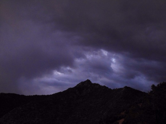
Section F can be really hot, but a surprise change in the weather brought cold, wind and rain.

Section F is really beautiful, with amazing panoramic views.

Here is a brief day by day rundown to catch up our blog readers:

Day 46
Sunday May 18th
Tehachapi Pass to Mile 583.9
We had a very pleasant zero day at the Best Western. Rather deluxe compared to the hotels we have been using recently, but we both felt like the splurge was worth it.

We met Sam and Claudia, local trail angels, while having breakfast in the motel and they offered to return us to the trailhead.

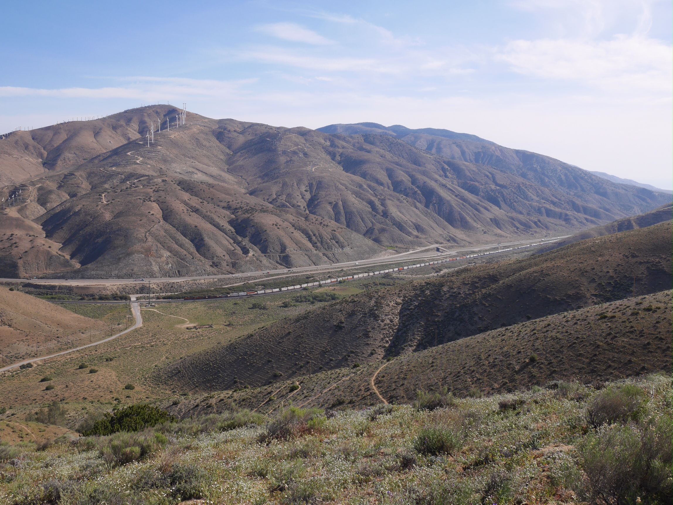
It was pretty windy at Tehachapi Pass, which made it a big struggle at times to make it up the big climb but we made the 17.5 miles to Golden Oak Spring, where we found good water.

Day 47
Monday May 19th
Mile 583.9 to Mile 603.9
We got an early start and made good time as we hiked past wind farms, through a burn area, over Hamp Williams Pass to excellent water at Robin Bird Spring. We continued about two miles past the spring to camp.

Day 48
Tuesday, May 20th
Mile 603.9 to Mile 622.5
We passed several good water sources early in the day and Deb even found time to rinse out some clothes using a zip lock bag as a wash basin at Landers Camp. Here we also met Forrest of the PCTA, who was scouting out the camp conditions for a work crew.

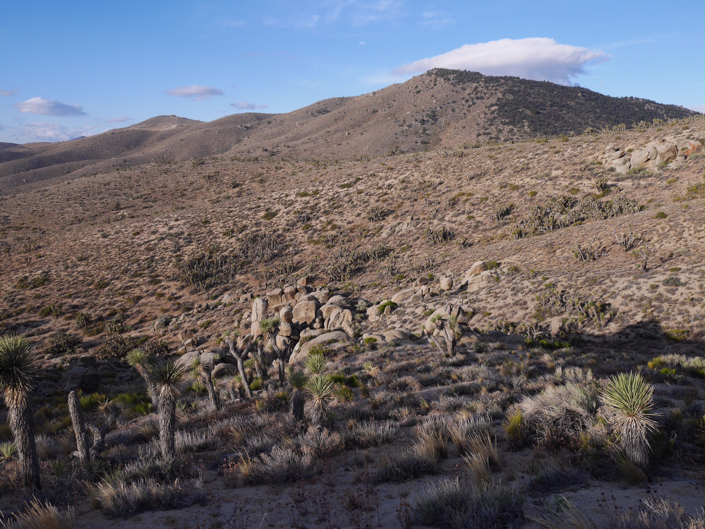
The water situation in this section changes dramatically around mile 616. In the past water caches have been maintained at mile 616 and mile 631, but the person doing that is no longer able to continue this. Water caches aren’t absolutely necessary, but they can make hiking dry sections of the trail easier. Anyway, the water cache at mile 616 was empty, so we hiked to the water two miles off the trail near mile 620. We decided to carry enough water to reach Walker Pass in 32 miles (13 liters between the two of us).

When we made it back to the trail it was incredibly windy, but we were lucky to find a place to camp sheltered by a large boulder and Joshua Trees.

Day 49
Wednesday, May 21st
Mile 622.5 to Mile 641.2
Cool windy weather continued this morning. The trail was sandy, and deep sand at times, one of the many features making this trail section a final performance test before entering the Sierra. Turns out there was water at Bird Spring Pass, but we didn’t need any because we were carrying enough. It rained several times in the afternoon, and also as we were setting up the tent for the night.

Day 50
Thursday, May 22nd
Mile 641.2 to 656
We packed up our wet tent and other gear, and headed down the PCT to Walker Pass. We had arranged to meet Dal who was going to collect the data from the GPS trail logger and change the case to a waterproof one. Dal also resupplied us with the 2.5 days of food we had bought in Tehachapi, so we could hike on to Kennedy Meadows without having to go into Lake Isabella to resupply.

We were also surprised by awesome trail magic at the Walker Pass campground, thanks Yogi.

We spent a few hours at the campground, and only hiked four miles past Walker Pass to a very nice campsite where we made an early camp and relaxed the rest of the day.

Categories
Walking

Blog Update Note

As we leave Tehachapi tomorrow, we will be leaving behind the relatively populated Southern California. This also means cell phone coverage, and the ability to update this blog, will be limited too. We will do the best we can, but expect less frequent updates. I will be sending more updates to my Twitter account which I can update from anywhere via the InReach satellite text messaging device.

Categories
Walking

Day 44-45: Oak Creek to Tehachapi Pass

Friday was a short day hiking on the Pacific Crest Trail to Highway 58 and Tehachapi Pass, where we were met by White Jeep and Dal. They gave us a ride into the town of Tehachapi and swapped out the GPS trail logger with a new version with updated software.

We decided to take a zero day Saturday to rest and recover and escape the heat. This is only our second zero day of the hike not related to attending ADZPCTKO (the kickoff event.) The hiker friendly and very nice Best Western here is full of hikers doing the same thing.

We quickly got our chores done (lunch, showers, laundry, and groceries) and settled into our nice room. The pool and jacuzzi also awaited us.

Tomorrow we will start hiking a dry section of the PCT, and will likely have heavy packs due to the water we will need to carry. In about a week we will reach Kennedy Meadows and shortly after that we will be in the high mountains of the Sierra Nevada.

Photo: Tehachapi Pass

Trail Date: May 16-17th

Mileage: 8.2 miles

Categories
Walking

Day 43: Mile 538.6 to Oak Creek

We were happy to be back on real trail today as the heat and road walking the past two days have taken a toll on our feet. However the trail tread continued to be very sandy and we had three climbs today. Deb’s pinky toe has a pretty serious blister, and Lon had his first blister of the hike. Fortunately Lon’s blister is small and a little tape took care of it. Deb was not so lucky. Dr. Lon exercised his mastery with a needle and drained her blister with thread, which she left in overnight to dry out the blister.

Eventually the trail led to a (surprising to us) water cache with chairs. We were carrying enough water so we just signed the register. We encountered Heidi from the Pacific Crest Trail Association there too, doing some survey work in connection with the BLM to protect the trail from motorcycle use.

We camped at the first road crossing into Tehachapi, planning to finish the remaining 8 miles in the morning.

Photo: Tehachapi, the land of windmills and wind farms.

Trail Date: Thursday, May 15th

Mileage: 19.6 miles

Categories
Walking

Day 42: Hikertown to Mile 538.6

We got a 6:30 am start from Hikertown since it was forecast to be warm today.

The Pacific Crest Trail follows a covered aqueduct for 17 miles, so today was not exactly the scenic highlight of the trail.

One would think that flat walking would be easy for hikers but that wasn’t true for us. The road walking yesterday put different pressures on our feet. Today the “trail” options were to walk on the concrete covering the aqueduct or walk on the sandy jeep road beside it. Our feet were unhappy. Deb had to break out her iPod for the first time on this entire thru-hike. She is thinking her body isn’t designed for road walking. Her hint for future hikers is to consider taking a zero at Hikertown to give the body a rest between the two road walks.

When we reached the Cottonwood Creek Bridge we joined 10 other hikers relaxing in the shade waiting out the afternoon heat. We fixed dinner and about 5:30 hiked on to an awesome hilltop campsite above the windmills. We had views of the town lights, the full moon, and we were surrounded by the red blinking lights on the windmills. Surreal.

Photo: The view from camp above the wind farm.

Trail Date: Wednesday, May 14th

Mileage: 21 miles