Categories
Walking

Day 12: Mile 144 to Hurkey Creek Campground

We reached the closure of the Pacific Crest Trail at mile 162.6 this morning and began our little adventure of finding a way around the Mountain Forest Fire closure area. So far, it has gone pretty well.

In case anyone is interested, this is the route we took:

At the PCT closure signs we took the unsigned trail fork (opposite direction from Cedar Springs) that switchbacks down the west side of the mountain and eventually ends at paved Morris Ranch Road.

We followed Morris Ranch Road south (left) until we found a gate for an unpaved road near a powerline. The signs at the gate say “Fobes Trail 4E04” and “Road 6S05 1 1/2.”

Enter the gate and follow the unpaved road (and powerline) to a dry creekbed just east of Hwy 74.

We continued following the powerline to Hwy 74, through the gates on both sides of the highway and continuing west to a larger powerline.

We followed the unpaved road under the larger powerline north as it parallels Hwy 74.

When we reached Thomas Mountain Road (6S13) we road walked a little over a mile on Hwy 74 to the Hurkey Creek Campground, where we are spending the night before continuing part two of the adventure tomorrow.

This alternate route was about 11.3 miles after we departed the PCT. We did not see any water on this route except for the Lake Hemet Store near the end.

A Google Earth track of our route is here or a .GPX format here.

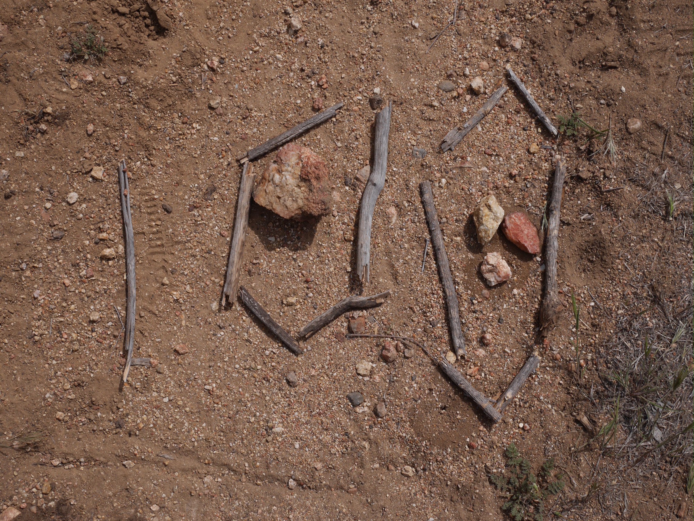
Photo: The Pacific Crest Trail is closed at mile 162.6 due a wildfire last year.

Trail Date: Monday, April 14th

Mileage: 15.5 miles

Categories
Walking

Day 11: Mile 144 to Mile 158.4

Ever since the fourth day of our Pacific Crest Trail hike, when we left Mount Laguna, we have been watching Mount San Jacinto grow a little larger on the horizon each day as we hike closer.

Well, it’s gotten really large now, as it’s a big mountain and we are camped just 14.8 miles as the crow flies from the summit.

Sadly, the PCT is closed 4.3 miles ahead due to a wildfire last year, so we will be exiting the PCT on a side trail and finding an alternate route into the town of Idyllwild. Usually the Forest Service creates alternate routes in situations like this, but none have been created so far. We are on our own to find a way around the closure. I have researched several options, and don’t expect this to be too big of an issue.

We are camped not far from Tunnel Spring, where we planned on getting water this evening. It turned out to be flowing much slower than we expected. It took about 7 minutes to fill a liters container and between Deb, myself and another hiker we needed quite a few liters.

Photo: Hiker “All Day Long” collects water from the trickle flowing into the algae filled trough at Tunnel Spring.

Trail Date: Sunday, April 13th

Mileage: 14.4 miles

Categories
Walking

Day 10: Chihuahua Valley Road to mile 144

Another 8:30 start time (again), we need to improve on that. It was day two of pain free hiking for Deb thanks to borrowing Lon’s knee strap. She’s turning into a very happy camper.

We took a pleasant long lunch break at Tule Spring.

A pretty day of hiking, especially around the Nance Canyon area.

We are cowboy camping again, having only used our tent twice. We are with about a dozen other hikers, all of us departed Trail Angel Mike’s this morning.

Photo: Cowboy camping in a field of boulders.

Trail Date: Saturday , April 12th

Mileage: 16.8 miles

Categories
Walking

Day Nine: Highway 79 (2nd Crossing) to Chihuahua Valley Road

We woke up well fed and rested. Monty dropped us off at the trailhead and we began our hike.

Deb bounded up the trail full of energy. She wants to know what the magic ingredient is that Monty served in the meals, because she was full of energy all day.

We arrived at Trail Angel Mike’s place, expecting only water and a place to camp, but found trail magic. Tom from Kennedy Meadows was helping Kushy, and they served an excellent dinner and breakfast the next day.

Photo: Chihuahua Valley Road where Trail Angel Mike’s place is located.

Trail Date: Friday , April 11th

Mileage: 15.9 miles

Hiker Tips: Get a head start on the hike to Chihuahua Valley Road, consider camping North of Warner Springs along Agua Caliente Creek.

Categories
Walking

Day Eight: Barrel Spring to Warner Springs (2nd crossing of Hwy 79)

Today was a short day of hiking, just eight miles to Warner Springs. We stopped at the Community Resource Center for lunch, where they have set up an excellent “PCT Hiker Rest Stop and Shop.”

After lunch we hiked two more miles to the second road crossing, where our friend Warner Springs Monty picked us up and hosted us along with several other hikers.

Photo: Poppies in bloom south of Warner Springs

Trail Date: Thursday, April 10th

Mileage: 10.3 miles

Categories
Walking

Day Seven: San Felipe Hills (1st Gate) to Barrel Spring

Today we reached the 100 mile point. 101.1 miles actually, since we are camped at Barrel Spring. We are just five miles short of completing 4% of the Pacific Crest Trail.

We are both still enjoying the hike, the amazing views and the wonderful hiking community. Neither of us have any blisters and we are both happy and healthy.

Tomorrow we only hike 10 miles to the community of Warner Springs where we will be hosted for the night in the home of our friend Warner Springs Monty.

Deb is looking forward to a shower and clean laundry.

A chorus of frogs is serenading us to sleep.

Photo: A hiker created a milestone marker made of sticks at the exact location of 100 miles from Campo. The Halfmile App must have been used.

Trail Date: Wednesday, April 9th

Mileage: 15.1 miles